Visscher 1689 Map of Ireland Art Print | Historic Irish Cartography
Visscher 1689 Map of Ireland Art Print | Historic Irish Cartography
40×50 cm / 16×20″
Couldn't load pickup availability
- Free Worldwide Shipping
- Ships in 2–5 Business Days
- 30-Day Quality Guarantee
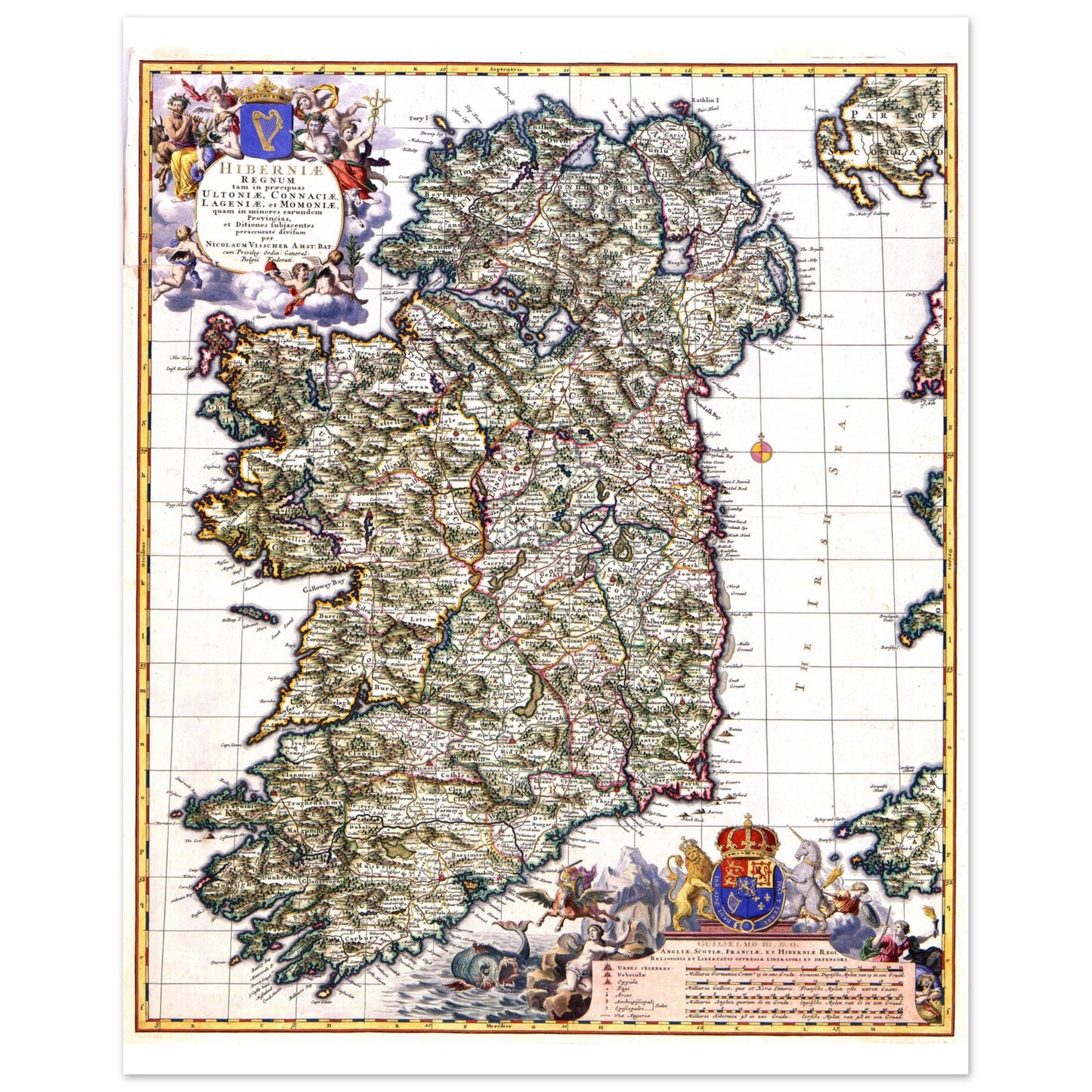
Map of Ireland (c.1689) – Nicolaes Visscher II
First published circa 1689 at the height of Amsterdam's Golden Age of cartography, this distinguished map of Ireland by Nicolaes Visscher II represents one of the finest engraved interpretations of the island from the late seventeenth century.
Issued during the reign of William III and Mary II, the composition combines geographic authority with decorative refinement. Provincial boundaries, rivers, coastal inlets, and settlements are rendered with precision, while elaborate baroque cartouches frame the map as both political statement and artistic object.
Produced in the renowned Visscher workshop, the engraving reflects the intellectual and commercial dominance of Dutch mapmakers in European publishing during this period.
Historical Significance
Seventeenth-century Amsterdam was the centre of European cartographic production. The Visscher family name became synonymous with engraving excellence, producing maps that were collected not only for navigation but for scholarship and display.
Sizes & Format
- 40 × 50 cm / 16 × 20″
- Available framed (black, white, wood) or unframed
Print & Frame Details
Archival matte paper, 250gsm (110lb), acid-free and FSC-certified — off-white, uncoated. Framed prints: solid oak or ash wood frame, 20mm thick, with shatterproof protective glazing. Ready to hang, hanging kit included. Unframed prints up to A4 ship flat; larger sizes ship rolled in a protective tube.
Free Worldwide Shipping
Framed prints are packed with protective corners and wrap, boxed with reinforced edges, and braced with internal supports for extra rigidity (max 3 frames per package). Every order ships free, made to order and delivered from the hub closest to you: Ireland 3–7 business days · UK 4–8 · USA 5–10 · Canada 6–12 · Australia 7–14.